20-plus miles, Ravenglass to Whitehaven
The day begins with a detour, to Muncaster church, mostly to check out a “Viking Cross”, which doesn’t look as good as the drawings in the guidebook, although it is curiously arranged – lined up in the churchyard apparently with all of the 18th and 19th century graves – presumably not its original position. In the church is a broken bell – rather roughly cast, with lots of air bubbles, but then it was made about 1470 to commemorate Henry VI’s stay at Muncaster after the battle of Hexeth.
On the wall are many plaques to the local lords of the manor, here since the 14th century, eg. “In memory of Will Pnyngton Arm: whose first wife was Joan Wharton, daughter of Thomas Lord Wharton, the second wife was Dame Bridgett Askew, daughter of Sir John Hudlleston by whom he had three sons… William Pnyngton and all his tried horsemen were called upon in service at the borders 1543.”
The local ladies cleaning the church – doing community duty but curiously uninformed about its history – were cheeringly impressed by what I was doing – well I may have played it up a little… “It’s only about 160 miles,” (airy wave of the hand), “no big deal…”
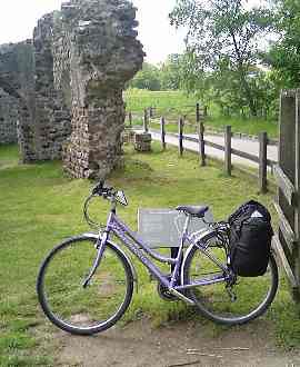
Then it was back to the official start of the ride, the Roman bath-house for the obligatory mugging at the camera start of the ride picture…
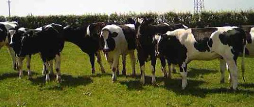
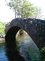 First highlight was the gorgeous humpbacked packhorse bridge over the River Irt – not easy to find, and a group of young Fresian ladies were most astonished to see me, but definitely worth it. You can see the places where centuries of horses have put their hooves in the same spots, wearing steps into the originally curved surface.
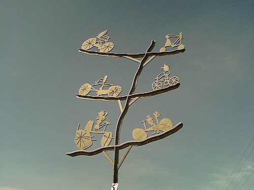
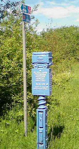 The route then runs along the seashore to Sellafield – a great long expanse of open beach, along which the odd dog was frolicking. There, it picks up and follows, on and off, a disused railway converted into a cyclepath all of the way to Whitehaven – a great route to my mind, the excellent thing about railways being that they are always flat, more or less. It is also marked by some great signs, and fancy sculptures, and once I got closer to Whitehaven is very well signposted as route 72, intermixed with route 71, which is the coast to coast. (I talked to a couple in Whitehaven who’d done that; they looked exhausted!)
Had lunch in the White Mare at Egremont, which had a nice beer garden overlooked by the church tower – in the characteristic local red stone that I first saw the packhorse bridge.
Whitehaven is, however, a bit of a dump; a serious port town – still with lots of yachts and quite a few fishing boats. It obviously boomed in Georgian times, with lots of very fine buildings around the wharf, and later in Victorian times, with fine homes on higher ground, where the B&B is, but has seen hard times since. Lots of millennium money was put in – with fancy fish-shaped bicycle racks! all the quay, museums etc, yet it is the sort of town where local youths get their kicks driving around blowing their horns at each their mates, and there are only two restaurants-cafes on the waterfront – one decent-looking one, but it won’t serve food outside! (The landlady later told me the council won’t allow it!)
Ended up eating at the Jasmine Palace (chips with everything on request) which would have had some view of the harbour if they hadn’t had the blinds closed. Had to try the “tom yum soup” – made with gravy powder with added chilli: Train-crash dining. And artery-clogging country; every group had at least one hideously obese person a it – a number of them had several. This makes a funny place for starting the C2C route – really two parts of Britain meeting, in mutual incomprehension.
Today’s reading was Landscape and Society in Medieval Cumbria, Angus J.L. Winchester, John Donald, Edinburgh, 1987, which picks up nicely where yesterday’s left off.
It is a tale of advance and withdrawal. After the Norman conquest is a period of withdrawal and stagnation, but this was followed in the later 12th and 13th century by a great take-up of previously “waste” land. The elements of this for which great landowners and monasteries were responsible, which included vaccaries, large herds of cows, have received most attention, but Wincheser argues that peasant colonisers were also pushing out into new assarts or “forlands” around their existing holdings, with summer grazing land also converted into separate settlements.
After this came the seemingly inevitable backlash. Border hostilities, the Black Death and animal epidemics – the rinderpest of 1319-21 and the sheep ‘murrain’ all combined to see a sudden contraction of the economies and the expanse of settlement. (The early 14th-century peak would not be matched again until the Napoleonic era.)
In the South of Cumbria at least the development restarted in the later 15th century with the growth particularly of the textile industry; but the north continued to suffer from border instability well into the 16th century.
The communities in the “forest” areas tended to be relatively homogenous -most farmers were tenants “at will”, a secure and relatively independent form of landholding. The relatively late-settled areas – post-Norman – saw farmers holding the arable land individually, but it was management of the open pastures of the fells in which the community had to work together. The reverse was true on the longer settled lowlands, where farming was in common areas (which were grazed by stock in winter). There are free men, bond men, tenants at will, tenants by charter, cottaegrs, leaseholders, tenants by custom, selfodes. The core was of bovate holders, unfree villeins who owed money or food rent, plus labour, although this was usually much lighter than in the midlands, a few days a year.
The story of the forests – or the end of them, is interesting. Little woodland survives in the lowlands outside the great forest of Inglewood (which was on heavy clay soil; hard to cultivate). Pollen analysis indicates the Solway lowlands were deforested by 800AD.
There are few records, but the history of the pig provides a surrogate. Where the woodland survived the pig was around well into the 14th century”Between 1308 and 1370 pannage virtually ceased to produce any income on the manors in the honour of Penrith… By the 15th or 16th century a pig or two for home consumption was all that was found on most farms. (p. 191-102)
Otherwise, in general tenants had a right to timber for their own use, particularly estover (the right to take dead wood for fuel), and housebote, haybote and ploughbote (for the repair of house, enclosure and ploughs respective).

One comment
Pingback: Theatre Review: White Open Spaces at the Soho Theatre - MY LONDON YOUR LONDON