Day one, the adventure begins.. well if you count five hours-plus on a train as an adventure. Virgin West Coast line to Carlisle, 20 minutes late; just made the milk-run train to Ravenglas connection, which was handy since there wasn’t another for two hours.
Was navigating that route with a map of the kingdom of Cumbria in about 1100AD, so not entirely clear where I was, and the Sellafield nuclear plant, near the ancient church town of St Bees came as a bit of a surprise. The guesthouse “Muncaster Country” is very pleasant – lovely gardens on to the fields – even boasting wireless internet access, although for five pounds a night I think I’ll pass.
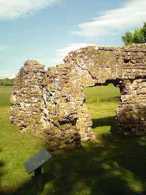
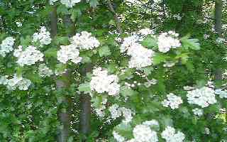 Took a stroll down to town along the ancient footpath – a profusion of mauve rhododendrons, the May bush in full flower, a couple of sound-asleep mallards beside a very shallow stream. Further down the stream’s course it forms a pond, which was the reservoir for the Roman bathhouse, parts of which still stand to more than 12 feet, at the base of the hill. It was just outside the corner of the Roman fort, the outline of which can be seen. (Most of it hasn’t been excavated.)
Ravenglass (a Roman port because the confluence of three rivers, the Irt, Esk and Mite, produced a sheltered harbour) it now might be best described as a hamlet – two pubs, a couple of guest houses, and a very fat Jack Russell called Penny, which I could still be patting. The sea shore is a mix of sand and gravel – inter-tidal life consisting of sea lettuce, brown seaweed further down, and very small barnacles, the odd periwinkle, and obviously some sort of pipi out there somewhere, to judge from the broken shells.
The day’s reading, courtesy of the London Library, was Land of the Cumbrians: A Study in British Provincial Origins AD 400-1120, by Charles Phythian-Adams, difficult but interesting. I’m not quite sure why some authors of monographs have to try so hard to make them readable only by experts. Major characters and perhaps even kingdoms (well princedoms) keep being introduced without any explanation; I’d reckon there’s half a dozen people in the world with whom this is envisaging a conversation, yet it wouldn’t add much length or be too much trouble for the experts to skip over.
Anyway, I’ve made sense of most of it. Basically, it is a highly revisionist history, tackling a number of claims that seem to date back a century or in some cases many centuries, but based on flimsy or no evidence. Th basic thesis is that the Norman fiefdoms and royal demense did not necessarily follow earlier cultural, religious or political boundaries. Instead the author argues – chiefly from place-name evidence, with a bit of archaeology thrown in, “Carlisle … until the days of Earl Siward … was probably more or less continously the seat of kings or sub-kings”, but their control only occasionally ran north of the Solway. The coastal region – so open to the Irish Sea, also had pretty much its own, very multicultural history. (p. 165)
read more »
