Despite the failure of the BBC weather forecasters to deliver on their promise of a sunny afternoon, I’ve just returned from a pleasant cycle tour through the history of Cambridgeshire (with a dominant overlay of Big Agriculture).
I started out from St Neots, a rather bleak and industrial town (although it has the remains of some nice coaching inns in the city centre) and is named after a relative of Alfred the Great, of whom I confess I had not previously heard. (And unlike the usual case in Britain, it is pronounced as it is spelt…)
My route took me through Offord Cluny, so named because the parish was owned from the eleventh to the fourteenth century by the Cluny monastery in Burgundy. (One in the eye for the Europhobes.)
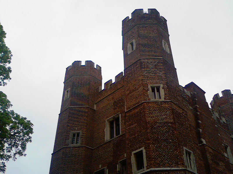
Next up was Buckden, a very wealthy-looking little place, with a few interesting historical features. I was taken by the slogan on the South’s Almshouse (1810) “Industry rewarded, age protected”, and by its architecture – I suspect lots of its features came from Buckden Tower next door, which was a grand bishop’s residence that sure its share of tragedy and drama.
This site (click on history) lists a good few of them, including its role as a jail for Catherine of Aragon as the divorce went through, and the place of death of Henry and Charles Brandon, son of Henry VIII’s favourite, the Duke of Suffolk. Their mother had them brough here from Cambridge to avoid the sweating plague, but it claimed their lives within 48 hours. (I think the general consensus is that we still don’t know what “sweating sickness” was.)

This is the Great Tower (restored in 1957) on the same site as the original in which the Queen stayed. “The foundations were laid about the year 1479 by Bishop Rotherham (1472-80), but this work ceased upon his death in 1480 and was not recommenced by his successor, Bishop Russell, until 1491. The lowest storey resting upon the vaulted arches of the great cellar, formed a large dining hall, the large apartment immediately above it being called the King’s Lodging.”
Then it was on to Bushmead priory, only to discover that it is only open for groups, so I missed out on the “”magnificent 13th-century timber roof of crown post construction with medieval wall paintings and stained glass”.
The Ordinance Survey map of the area is thick with notations in the Gothic script denoting historical buildings or remains: “moat”, “manorial earthworks”, “palace remains”, but the primary visual impression is of Big Agriculture. Huge fields of rape-seed in brilliant yellow flower were the most evident, but there were also a lot of summer cereals.
Total: about 33 miles (c. 55km). If I’m ever going to make the Dunwich Dynamo I’m going to have to do this and more at least once a week. I think most of my body can make it; not too sure about the knees, however.
The route came from:

 About
About